'These human-scale books, written and published by people who genuinely know and love their subject, are perfect for travel's post-pandemic recovery.'
— The Guardian, March 2021

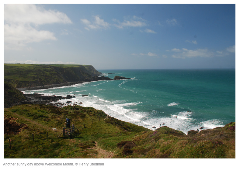
Exmoor & North Devon Coast Path (South-West Coast Path Part 1)
Excerpt:
Using this guide
Contents | Introduction | About the South West Coast Path | Practical information for the walker | Itineraries | Using this guide | Sample route guide: Minehead to Porlock Weir
 Using this guide
The route guide has been described from east to west and divided into ten stages. Though each of these roughly corresponds to a day’s walk, do not assume that this is the only way to plan your walk. There are so many places to stay en route that you can pretty much divide up the walk wherever you want. However, see pp29-30 for some suggested itineraries.
To provide further help, practical information is presented on the trail maps, including walking times, places to stay, camp and eat, as well as shops where you can buy supplies, and public toilets. Further service details are given in the text under the entry for each settlement.
For a condensed overview of this information see the village and town facilities table on pp32–3.
TRAIL MAPS
Scale and walking times:
The trail maps are to a scale of 1:20,000 (1cm = 200m; 3â…› inches = one mile). Walking times are given along the side of each map and the arrow shows the direction to which the time refers. Black triangles indicate the points between which the times have been taken. See note in box on p74 on walking times.
The time-bars are a tool and are not there to judge your walking ability. There are so many variables that affect walking speed, from the weather conditions to how many beers you drank the previous evening. After the first hour or two of walking you will be able to see how your speed relates to the timings on the maps.
Up or down?
Other than when on a track or bridleway the trail is shown as a dotted line. An arrow across the trail indicates the slope; two arrows show that it is steep. Note that the arrow points towards the higher part of the trail. If, for example, you are walking from A (at 80m) to B (at 200m) and the trail between the two is short and steep it would be shown thus: A—»—B. Reversed arrow heads indicate downward gradient.
Exmoor & North Devon Coast Path (South-West Coast Path Part 1)
Excerpts:
- Contents
- Introduction
- About the South West Coast Path
- Practical information for the walker
- Itineraries
- Using this guide
- Sample route guide: Minehead to Porlock Weir
Price: £12.99 buy online now…
Latest tweets