Trailblazer guidebooks provide practical information on specific routes in less accessible parts of the world.
— Wanderlust
Hadrian's Wall Path
Excerpt:
Using this guide
Contents | Introduction | About Hadrian's Wall Path | Planning your walk | Using this guide | Sample route guide: Heddon-on-the-Wall to Chollerford
Using this guide
The trail guide has been described from east to west and divided into six different stages. Though each of these roughly corresponds to a day’s walk, do not assume that this is the only way to plan your walk. There are so many places to stay en route that you can pretty much divide up the walk wherever you want.
On p40 we have provided tables to help you plan an itinerary. To provide further help, practical information is presented on the trail maps, including walking times, places to stay, camp and eat, as well as shops where you can buy supplies, taps (for drinking water), phone boxes and public toilets. Further service details are given in the text under the entry for each settlement.
TRAIL MAPS
Scale and walking times
The trail maps are to a scale of 1:20,000 (1cm = 200m; 31/8 inches = one mile). Walking times are given along the side of each map and the arrow shows the direction to which the time refers. The black triangles indicate the points between which the times have been taken. See box opposite on walking times.
The time-bars are a tool and are not there to judge your walking ability. There are so many variables that affect walking speed, from the weather conditions to how many beers you drank the previous evening. After the first hour or two of walking you will be able to see how your speed relates to the timings on the maps.
Up or down?
The trail is shown as a dotted line. An arrow across the trail indicates the slope; two arrows show that it is steep. Note that the arrow points towards the higher part of the trail. If, for example, you are walking from A (at 80m) to B (at 200m) and the trail between the two is short and steep, it would be shown thus: A– – – >> – – – – B. Reversed arrow heads indicate downward gradient.
Accommodation
Accommodation marked on the map is either on or within easy reach of the trail. Details of each place are given in the accompanying text. The number of rooms of each type, ie S=Single, T=Twin room, D=Double room, F=Family room (see p27), is given with the contact details. The rates stated are mostly given as per person (pp), often with a supplement for single occupancy, but some places quote per room based on two sharing – in this case there is often a discount for single occupancy.
Other features
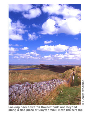
Features are marked on the map when pertinent to navigation. In order to avoid cluttering the maps and making them unusable not all features have been marked each time they occur.
Hadrian's Wall Path
Excerpts:
- Contents
- Introduction
- About Hadrian's Wall Path
- Planning your walk
- Using this guide
- Sample route guide: Heddon-on-the-Wall to Chollerford
Price: £13.99 buy online now…
Latest tweets