Trailblazer guidebooks provide practical information on specific routes in less accessible parts of the world.
— Wanderlust

Preview an Excerpt
Offa's Dyke Path: Chepstow to Prestatyn & Prestatyn to Chepstow
(British Walking Guide)
by: Keith Carter & Joel Newton
Out of print - New Edition Forthcoming
NEW EDN DUE 9 July 2024
ISBN 978-1-912716-03-6
5th edition
268 pages, 98 maps
32 colour pages including colour flower guide
120mm x 180mm, 5" x7"
- Keith Carter's Offa's Dyke Path is good, with amusing hand-drawn maps ...
- telegraph.co.uk - Fully updated and includes downloadable GPS waypoints.
- Strider - All the info you need
- Wanderlust - A useful guide.
- The Independent - Recommended.
- Country Walking - These guides are excellent.
- Jackie Ager
New two-way guide
This new edition has been rewalked in both directions - from Chepstow to Prestatyn and from Prestatyn to Chepstow and reformatted for use by walkers hiking south to north and north to south.
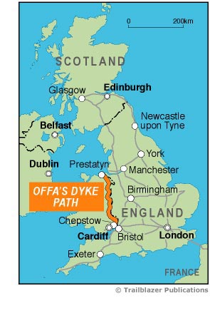 The Offa's Dyke Path is a superb National Trail that runs from the North Wales coast to the Severn Estuary following the line of Offa's Dyke, an impressive 8th-century earthwork along the English/Welsh border. The ever-changing landscape – the Clwydian Range, the Shropshire Hills, the Black Mountains and the Wye Valley – is steeped in history and legend providing 177 miles (285km) of fascinating walking.
- Includes 98 detailed walking maps: the largest-scale maps available At just under 1:20,000 (8cm or 3.15 inches to 1 mile) these are bigger than even the most detailed walking maps currently available in the shops.
- Unique mapping features Walking times, directions, tricky junctions, places to stay, places to eat, points of interest. These are not general-purpose maps but fully-edited maps drawn by walkers for walkers.
- Itineraries for all walkers Whether hiking the entire route or sampling highlights on day walks or short breaks.
- Detailed public transport information for all access points.
- Practical information for all budgets What to see, where to eat (cafés, pubs and restaurants); where to stay (B&Bs, hotels, bunkhouses, hostels & campsites).
- Downloadable GPS points included.
Updates:
Latest Updates for Offa's Dyke Path: Chepstow to Prestatyn & Prestatyn to Chepstow
Latest tweets