Trailblazer Guides are produced by people who know exactly what information is needed - not just to get from A to B but to be entertaining as well as informative.
— The Great Outdoors
The Ridgeway: Avebury to Ivinghoe Beacon
Excerpt:
About the Ridgeway
Contents list | Introduction | About the Ridgeway | Planning your walk | Using this guide | Sample route guide: Foxhill to Court Hill (& Wantage)
HISTORY
The Ridgeway is very ancient. It’s often described as ‘the oldest road in Britain’ and it’s clear that parts of the route were in use 5000 years ago or more. The Ridgeway, as we know it today, is in fact the middle section of the Greater Ridgeway (see p183), an ancient system of tracks that stretches from Lyme Regis on the Dorset coast up to Hunstanton on the Norfolk coast. These tracks evolved over centuries as people chose the driest and most suitable paths across the countryside for themselves and their animals.
During your walk you will still be able to see and touch stone structures dating back to the prehistoric days of the Ridgeway; the burial mound known as Wayland’s Smithy (see box p106) dates back to around 4000BC. Bronze Age stone structures also still stand, with the Avebury stone circle (see box pp72-3) and West Kennet Avenue (see box p75) being by far the most famous and accessible of these. Additionally, you can see numerous Bronze Age burial mounds dotted along the Ridgeway.
From the Iron Age there are several important hill forts to investigate including Barbury Castle (see p92) and Uffington Castle (see p108) plus earthworks such as
Grim’s Ditch (see box p142) also dating from this time. During the
Dark Ages the Ridgeway was used as a major transport route for
invading Danish Viking armies. By the late 9th century they
had conquered most of Saxon England and had
turned their attention to the kingdom of Wessex. In 871 they marched
west along the Ridgeway from their base by the Thames at Reading
only to be defeated by King Alfred at the Battle of Ashdown which
some think took place in the area around White Horse Hill.
Up until the 18th century the Ridgeway still consisted of a broad
network of routes across the country but then the Enclosures Acts
were passed by parliament and these initiated the division of previ-
ously communal open land into privately owned fields. These fields
were then hedged in to protect them from passing livestock and as a
result the Ridgeway was forced to follow a single, defined route.
As coaching routes to London developed they avoided the actual
course of the Ridgeway so it was left largely neglected – although
several towns on the path, such as Marlborough and Wendover, were
important rest-stops. The main users of the path, therefore, for several hundred
years were drovers transporting their sheep from the West Country, and even
Wales, to the large sheep fairs at East Ilsley (see p125). The width of the
Ridgeway in this area, sometimes up to 20 metres, gives an idea of just how
much livestock was transported on this route. At their peak the fairs held auctions
for up to 80,000 sheep a day though by the early 20th century these fairs were in
decline: the last one was held in 1934. From then on the path was used mainly
by farmers for access to their land.
This was especially the case during World War II when many of the hill-
sides around the Ridgeway saw a change in use from sheep-grazed areas to
cultivated fields. This was the result of a government-initiated effort to provide
sufficient food for the population as imports were threatened owing to the fight-
ing. This not only changed the visual landscape of many areas of the Ridgeway
but also damaged the indigenous wildlife as powerful chemical fertilisers were
used to improve the poor soil.
The first calls for the Ridgeway to be recognised as a long-distance walking
trail were made in 1947 by the National Parks Committee and in the 1950s the
Ramblers’ Association (now Ramblers; see box p36) joined the appeal.
However, it wasn’t until 1973 that it was officially opened as a National Trail,
since when, the most common use for the path has been for recreation. Only
minor alterations have been made to its course since then which enables every-
one to make their way along the 87-mile (139km) trail in the footsteps of the
first Ridgeway pioneers from thousands of years ago.
HOW DIFFICULT IS THE RIDGEWAY?
If you are reasonably fit you won’t encounter any problems walking the
Ridgeway. There are no sections that are technically difficult and despite having
a couple of steep climbs during each day’s walking, it’s nothing like as demanding
as many other National Trails. The most important thing to do is plan your walk-
ing based on your own abilities. If you try to walk too far in one day, not only will
you lose the chance to really enjoy the countryside you are walking through, but
you will end up exhausted and won’t feel much like walking the next day.
If anything, the western section of the Ridgeway, up to Streatley, could be
considered more difficult than the eastern section owing to its remote and
exposed conditions that become very apparent during bad weather. From
Streatley onwards the Ridgeway is often in woodland or passing through
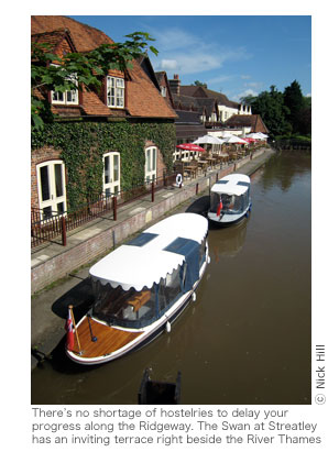
fields and goes through, or near to, numerous towns and villages.
Route finding
You shouldn’t have any problems staying on the Ridgeway. At nearly all the
junctions there are special ‘Ridgeway’ signposts clearly showing the direction
of the trail and other branching paths. For many stretches you barely even need
these signposts as the path is clear and well-trodden. However, it is always
worth checking them as at some junctions the Ridgeway does veer off from
what you’d consider the ‘obvious’ path. All path junctions are included on the
maps in this book along with relevant notes.
GPS waypoints
If you have a handheld GPS receiver you will be able to take advantage of the
waypoints marked on the maps, and listed on pp184-6 of this book.
Essentially a GPS will calculate your position on earth using a number of
satellites and this will be accurate to a few metres. You might say that if this is
possible, what is the point of taking paper maps and a compass with you? The
answer is that if the batteries go flat, or the machine malfunctions, you’ll have
only your sense of direction to fall back on. Depending on how good that is, you
might, or might not, be left wondering exactly where you are.
Having said this, it is by no means compulsory that you use a GPS in
conjunction with this guide and you should be able to get by with simply the
signposts on the trail and the maps in this book. However, a GPS can be useful
if for some reason you do get lost, or if you decide to explore off the trail and
can’t find your way back. It can also prove handy if you find yourself on the
trail after dark when you can’t see further than your torch beam.
If you do decide to use a GPS unit in conjunction with this book don’t feel
you need to be ticking off every waypoint as you reach it; you’ll soon get bored
and should get by without turning on your GPS for most of the trail. But if at
any point you are unsure of your position, or wonder which way you should
be headed, your GPS can give a quick and reassuring answer.
You can manually key the nearest presumed waypoint from the list in this
book into your unit as and when the need arises. Or, much less laboriously and
with less margin for keystroke error, you can download the complete list (but
not the descriptions) for free as a GPS-readable file from the Trailblazer web-
site. You’ll need the correct cable and adequate memory in your unit. This file,
as well as instructions on how to interpret an OS grid reference, can be found
in the updates section of the Ridgeway text on the Trailblazer website ( www.
trailblazer-guides.com).
HOW LONG DO YOU NEED?
This depends on your fitness and experience. Do not try to do too much in one
day if you are new to long-distance walking. Most people find that eight days
is enough to complete the walk and still have time to look around the villages
and enjoy the views along the way. Alternatively, the entire path can be done in
five days if you are fit enough, but you won’t see much of the surrounding
countryside.
If you’re camping don’t underestimate how much a heavy pack laden with
camping gear will slow you down. It is also worth bearing in mind that those
who take it easy on the Ridgeway see a lot more than those who sweat out long
days and tend to only ever see the path in front of them. If you are walking on
your own you can dictate the pace, but when walking with someone else you
need to take their abilities into account and take time to enjoy their company –
this may slow you down. If you don’t take time to do this, you might as well be
walking separately and simply meet up at the end of the day.
On all sections, but particularly the western section, you’ll also need to
consider how far off the path your accommodation is and build that distance
into your daily total. Although some B&Bs will collect you from the Ridgeway
and drop you back the next morning, not all offer this service so you do need to
check when reserving a room. On p28 there are some suggested itineraries
covering different walking speeds that will give you an idea of what you can
expect to achieve each day.
If you only have a few days it makes sense to concentrate on the ‘best’ parts
of the Ridgeway; there is a list of recommended day/two-day walks on p29.
The Ridgeway: Avebury to Ivinghoe Beacon
Excerpts:
- Contents list
- Introduction
- About the Ridgeway
- Planning your walk
- Using this guide
- Sample route guide: Foxhill to Court Hill (& Wantage)
Price: £12.99 buy online now…
Latest tweets