These Trailblazer guides … are a godsend for independent travelers.
— Travel & Leisure
Cotswold Way: Chipping Campden to Bath
Excerpt:
Contents
Contents | Introduction | About the Cotswold Way | Planning your walk | Using this guide | Sample route guide: Birdlip to Painswick | Stage Map and Trail Profile sample
 INTRODUCTION
Cotswold Way
History 9 – Geology 10 – How difficult is the path? 12
How long do you need? 12 – When to go 13
PART 1: PLANNING YOUR WALK
Practical information for the walker
Route finding 17 – Accommodation 18 – Food and drink 22 Money 23 – Other services 25 – Taking dogs along the path 25 Disabled access 25 – Walking companies 26 – Information for foreign visitors 26
Budgeting 29
Itineraries
Which direction? 31 – Suggested itineraries 32 – Side trips 32 Village and town facilities 34 – The best day and weekend walks 36
What to take
Keep your luggage light 38 – How to carry it 38 – Footwear 39 Clothes 39 – Toiletries 40 – First-aid kit 40 – General items 40 Camping gear 41 – Money 41 – Travel insurance 41 – Maps 42 Sources of further information 42 – Recommended reading 42
Getting to and from the Cotswold Way
Getting to Britain 44 – National transport 45 Local transport 47 – Public transport map 49
PART 2: MINIMUM IMPACT & OUTDOOR SAFETY
Minimum-impact walking
Economic impact 51 – Environmental impact 52 – Access 53
Health and outdoor safety
Health 56 – Outdoor safety 58 – Weather information 58 – Walking alone 58
PART 3: THE ENVIRONMENT & NATURE
Conserving the Cotswolds
Government agencies and schemes 60 Voluntary campaigning and conservation organisations 61
Flora and fauna
Trees and shrubs 62 – Wild flowers 63 – Butterflies 66 – Birds 66 Mammals 70 – Reptiles 72
PART 4: ROUTE GUIDE AND MAPS
Using this guide Trail maps 73 – Accommodation 74
Chipping Campden 75
Chipping Campden to Broadway 81 (Broadway 81)
Broadway to Winchcombe 89 (Stanton 92, Stanway 92, Wood Stanway 94, North Farmcote 94, Hailes 94, Winchcombe 96)
Winchcombe to Cleeve Hill 101 (Postlip 101, Cleeve Hill 102)
Cleeve Hill to Leckhampton Hill 105 (Cheltenham 105, Prestbury Hill Reserve 110, Ham Hill 110, Charlton Kings 112, Near Dowdeswell Reservoir 112, Seven Springs 115)
Leckhampton Hill to Birdlip 115 (Ullenwood 115, Around Crickley Hill 115, Birdlip 119)
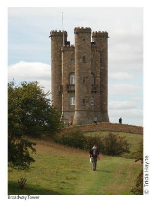
Birdlip to Painswick 119 (Little Witcombe 120, Cranham Corner and Painswick Hill 120, Painswick 122)
Painswick to Stonehouse 127 (Edge 127, Randwick/Westrip 128, Stonehouse 130)
Stonehouse to Penn Wood 130 (King’s Stanley 130, Middleyard 132, Ebley 132, Selsley 132)
Penn Wood to Dursley 134 (Nympsfield 134, Uley 134, Dursley 136)
Dursley to Wotton-under-Edge 141 (Stinchcombe Hill 142, North Nibley 142, Wotton-under-Edge 146)
Wotton-under-Edge to Old Sodbury 149 (Alderley 150, Hillesley 150, Hawkesbury Upton 150, Horton 152, Little Sodbury 154, Old Sodbury 154)
Old Sodbury to Cold Ashton 157 (Coomb’s End 157, Tormarton 157, South of the M4 158, Pennsylvania 162, Cold Ashton 162)
Cold Ashton to Bath 163 (Weston 165)
Bath 168
APPENDICES & INDEX
Map key 184 – Waypoints 185 – Walking with a dog 187 – Index 189
DISTANCE CHART 194
OVERVIEW MAPS & PROFILES 197

Cotswold Way: Chipping Campden to Bath
Excerpts:
- Contents
- Introduction
- About the Cotswold Way
- Planning your walk
- Using this guide
- Sample route guide: Birdlip to Painswick
- Stage Map and Trail Profile sample
Price: £14.99 buy online now…
Latest tweets